Subscribe!


 Posts
All Comments
Saturday, November 8, 2014

Monday, October 13, 2014
Inter-base rivalry
Some rangers decided to take a canoe and packs up the Tooth of Time at Philmont.
Balancing the canoe like (particularly with the packs in it) makes me cringe, but having climbed the Tooth of Time myself, I've got to say that managing to get a canoe up there is impressive.
 Source: Philmont Scout Ranch Facebook - October 2014
Balancing the canoe like (particularly with the packs in it) makes me cringe, but having climbed the Tooth of Time myself, I've got to say that managing to get a canoe up there is impressive.
Monday, July 16, 2012
Missing Up North
Despite having the time of my life studying abroad this summer, a part of me can't help but wish I was back Up North. I'll see friend's pictures or look up at the Quetico Map hanging on my wall and wish I could just take one more trip up Agnes or down the Basswood River.
For some fantastic pictures from other interpreters, go to the Northern Tier Facebook Page
Thursday, February 16, 2012
Northern Tier Memes
 |
| Courtesy of Spencer M, Bay Post Staff 2011 |
 |
| This one is a big pet peeve of most interpreters. Yes, Philmont can be intense. But it's not the true wild. You can shower. You can have meals made for you. You can have be taken off the trail pretty quickly if there's an emergency. |
Friday, January 13, 2012
Sandy Bridges Program Center (part II)
One of the things I never got around to was showing off a little bit more of the Sandy Bridges Program Center. So in a fit of nostalgia for Up North, here's some more information about it (at least as it was at the end of the summer).
 |
| The front of SBPC |
Out front is really nice (at least in the summer). I personally think that the large stones give a nice touch. Scouts could probably throw around a ball or Frisbee on the lawn after getting off water too. "The Boy Scout" statue also gives the area a nice little touch.
 |
| "The Boy Scout" |
 |
| "The Boy Scout" (click to enlarge) |
 |
| Main entrance |
The main entrance leads directly to the mess hall. Interpreters and leaders do official check-in (getting permits, checking paperwork, etc.) in an office directly by the entrance too.
All the goodies are upstairs. There is the porch, which is absolutely great for sitting with a Dorthy Malter's Root Beer, hanging out with a crew after a trip, or just relaxing anytime. The trading post and snack stand both see a lot of business.
 |
| The new trading post |
I love the new trading post. It is so much more spacious and could almost completely outfit a scout who wasn't prepared. There's not EVERYTHING (I don't think they have sleeping bags or pads), but there's certainly a lot. Need an Otterbox for your camera? Got it. Want a fashionable Northern Tier belt? Sure! Loved Hudson Bay Bread so much you want to make it at home? We've got mix. Want to read up on all the best fishing techniques? There are guide books. Loved your trip so much that you want start planning your own back home? You can even buy the the same (but new) packs you used on trail.
For a more complete list of what is offered at the Trading Post, go to their website: http://northerntiertradingpost.org/
I didn't spend nearly as much time in the snack shop, though it has some good stuff too (the root beer floats are great). Ice cream, candy, root beer, and slushies are some of the things they offer.
For most visitors, that's all there is upstairs. There's a sink and place to make coffee and a couple of conference rooms, but when I was there they weren't for crew use. I would guess that they'll be used more for training and official conferences.
All and all, having the new Sandy Bridges Program Center this last summer was fantastic. It's a great addition to the base.
Thursday, November 24, 2011
The end of the Polar Pure Age for Norther Tier?
Love it or hate it (as I know some of my crews did certainly did), Polar Pure has always been a constant at Northern Tier. Even if you used other methods for purifying water (I used bleach, chlorine tablets, filters, or boiling were this last summer), Northern Tier has always required crews to take out Polar Pure.
But now, that may change in the not-so-far-off future. The DEA has made it near impossible for 88-year-old Bob Wallace to continue to produce Polar Pure because iodine (the active ingredient in Polar Pure) is used in the production of crystal meth.
DEA Says Polar Pure is being used by Meth Labs
At this point it's unknown what will happen to current stocks of Polar Pure, but I would suspect that they'll be left alone. Given how long each bottle of Polar Pure lasts (2,000 quarts water purified), Northern Tier's stock could last a long time, especially since we got a shipment from Philmont this year (Philmont has switched away from Polar Pure to chlorine tablets - they sent us their remaining stock). Polar Pure, however, is one of the most frequently lost or broken pieces of equipment that the Bay Post sends out, so well see how long it lasts before it's the of Polar Pure at Northern Tier.
Wednesday, November 2, 2011
Work at Northern Tier!
Want an absolutely amazing summer job? Work at Northern Tier and have the summer of your life!
Tuesday, September 27, 2011
An End and a Beginning
There's a lot I can say about this summer, but if there is one thing that sums it up more than anything else, it was that this summer was absolutely AMAZING. I loved the people I met this summer, whether it was the people I worked with or the crews that I guided. You all made my summer great.
Unfortunately, it was so great I did not get enough time to finish all the blogs I wanted: my last couple of trips, another on the new Sandy Bridges Program center, one on Leave No Trace. Hopefully I'll get around to writing them eventually, but for the moment I have a new adventure: studying abroad in Germany.
Thank you everyone for the fantastic summer.
To end, I have this poem from Sam Cook:
“Up North is a certain way the wind feels on your face and the way an old wool shirt feels on your back. It’s the peace that comes over you when you sit down to read one of your old trip journals, or the anticipation that bubbles inside when you start sorting through your tackle box in the early spring.
Up north is the smell of the Duluth pack hanging in your basement and the sound of pots clinking across the lake. It’s a raindrop clinging to a pine needle and the dancing light of a campfire on the faces of friends.
Up north is a lone set of cross-country ski tracks across a wilderness lake and wood smoke rising from a cabin chimney. It’s bunchberries in June, blueberries in July and wild rice in September.
Each of us has an up north. It’s a time and place far from the here and now. It’s a map on the wall, a dream in the making, a tugging at one’s soul. For those who feel the tug, who make the dream happen, who put the map in the packsack and go, the world is never quite the same again.
We have been Up North. And part of us always will be.”
-Sam Cook as quoted from his book "Up North."
Thursday, August 4, 2011
3rd Trip - Horse River I
So I am finally getting around to writing this blog. As I mentioned in my last post, I was unable to take pictures on this trip. It's been a while and I have had 2 trips in between, so I may have forgotten some of the finer details of the trip as well.
In summary, my crew (who were a lot of fun) paddled for 5 days for a total of 75 miles. I only did 65 of those miles because I stayed in camp for the other 10. We had Alumacraft canoes.
Day 1: Moose Lake (Base) to Pipestone Bay (Basswood) via Hoist Bay
Our first day we left base and quickly hit the portages in and out of Wind Lake. Both portages are about a half-mile long and can be rough for new crews. We had a floating lunch after getting passed Wind Bay. From there we pushed down through Hoist Bay, up Back Bay, and across into Pipestone Bay, where we made camp. The campsite we had is one of the biggest I've seen in the BWCA, which was nice. That night I tried making apple pie (with apples saved from lunch) for the first time. It was delicious.
Day 2: Pipestone Bay (Basswood) to Basswood River via Horse Lake
We pushed hard our second day. From Pipestone Bay, we portaged into Jackfish, paddled a creek, went through Sandpit Lake, Tin Can Mike Lake, Horse Lake, and up the Horse River. All told we had 8 portages and 4 or 5 river walks that day. We had lunch on Horse Lake and camped on a peninsula between Lower Basswood Falls and Wheelbarrow Falls.
Day 3: Basswood River to Basswood Lake
Day three was short. Before loading the canoes, we went west past Lower Basswood Falls to visit the pictographs on Crooked Lake. We ate breakfast at the falls. We then pushed back east up the Basswood River through the Horse Portage to our campsite, which wasn't far.
Day 4:
We were hoping to do a dawn paddle down the length of Basswood, but unfortunately the wind was still kicking when I woke up at 3:00 AM. We delayed wake up a while and still ended up getting on the water early. We saw a large group of bald eagles rounding United States Points: 3 or 4 mature and 7 or 8 immature eagles (immature eagles do not yet have the white head or tail feathers). Unfortunately, the campsites that I had hoped to stay at were taken by motor boater campers, so my crew decided to push on to Horseshoe Island in Newfound Lake. It was a good long day. The campsite on Horseshoe I. is great for swimming, so we took advantage of that.
Day 5:
Our last day we slept in (a little) before having oatmeal and cinnamon rolls for breakfast. My crew did the necessary laps around the island to push them up to 75 miles for the trip and we headed off to Scout Island and base.
For their skit the, the did a rewrite of "In the Jungle, the lion sleeps tonight." If any of you are reading this, I want the lyrics.
Although I'm generally not a fan of short trips, the crew was great, the trip was great, and I would have loved to make it longer.
Thursday, July 21, 2011
A lack of time and sleep
Unfortunately I was unable to write much of a blog for my last trip. I will be sure to write one the next day I have off (which is in over 2 weeks after 2 trips). For the mean time though, suffice it to say that it was great. The crew was great, the weather was great, the food was great, and the trip was great.
We did a Horse River Loop, found blueberries, covered some miles (65 for me, 75 for the crew after doing laps around Horseshoe Island), and swam. We paddled 5 days (Alumacrafts) and camped 4 nights. More information to come later. Unfortunately, I forgot my camera batteries and so had no pictures.
I leave on my next trip tomorrow, a 80-mile trip up Agnes, across Kawnipi, and down Kahshahpiwi for 6 days. I should be pretty cool. When I get back, I'm on a "turn and burn." I get off water, my crew leaves the next day, and I get a crew that afternoon. No rest for the weary. On the flip side, I do get 3 days off after I get back.
Tuesday, July 12, 2011
A Beautiful Night
It was a beautiful night... A purple sunset, a rising full moon, and ice cream from the OA.
Going on trail tomorrow on a Horse River Loop.
Going on trail tomorrow on a Horse River Loop.
2nd Trip - Modified Argo-Darky Loop
And I’m back from another great trip with another fantastic crew! The trip was 9 days on water; we covered 126 miles in 8 days of paddling (we had one layover day where we did not move campsites). My crew already had a route planned when they came up so I did not help much with that. I did offer campsite suggestions and the addition of a layover day instead of a couple of very short days at the end of the trip.

Day 1: Base (Moose Lake) to North Bay (Basswood Lake)
We got out off base even faster than my first trip, despite not having gotten canoes the day before. We reached Prairie Portage well before noon, checked in, saw a float plane resupplying the station, and moved on before lunch. We ate on an island in Burke Lake before moving on to an island in North Bay. The island was clearly a frequently used campsite, which has its pluses and minuses. On one hand, the tent pads were well developed and there was plenty of room to teach the participants about setting up camp. On the other hand, there were clear Leave No Trace issues (I’ll go into Leave No Trace in another post). It was a good first day.
 |
| Float plane resupplying Prairie Portage ranger station |
 |
| Sunset on North Bay |
 |
| Sunset on North Bay |
Day 2: North Bay (Basswood Lake) to Moose Bay (Crooked Lake)
We woke up decently early & got out of camp, paddling south-west out of North Bay down below White Island toward the Basswood River. The first portage we hit on the Basswood River was the mile-long Horse Portage. For my crew, many who had never portaged before a day earlier, it was rough. Despite the adversity, my scouts pushed through, refusing to give up their packs and insisting that they wanted to finish it. They did a great job and then went on and pushed through three more portages (though none were nearly as long)! Once we made it to Crooked Lake, we stopped briefly at the pictographs left by the Objibwe people and before stopping at Moose Bay. That evening my crew went swimming and fishing, with one of the youth catching his first fish ever, a good sized bass (unfortunately I was not there and did not get a picture).
 |
| North Bay in the morning |
Day 3: Moose Bay (Crooked Lake) to Argo Lake
We got another good start the next morning up Crooked Lake. We only had one portage (later in the day), so we had a nice long paddle. We had several small breaks, including one at the remnants of a 1924 Buick. It’s a random site to see in the park, but certainly interesting. After lunch we too the western-most portage into Argo from Crooked. Argo Lake has some of the clearest water in the Quetico and it was apparent at the end of the portage trail. We fought some wind to get up to our desired campsite on Birch Island, but I thought it was worth it. The campsite has a gradually sloping shelf that extends maybe 50-100 ft. out into the lake that you can walk out on before it gets too deep. After making camp, I spent some time on the shelf fishing and caught several bass (most which were too small to keep). We did catch two bass and a trout worth keeping, which we cooked up and ate along with some great chocolate chip muffins.
 |
| Two bass and a lake trout. One of the bass is mine; unfortunately I was blinking |
 |
| Chocolate Chip Muffins! |
Day 4: Argo Lake layover day
The next day we stayed on Argo all day. Most of the crew slept in, but I woke up at 5:30 to take out a canoe and try to find some walleye. Unfortunately, I did not have much luck with anything until I went back in closer to shore with one of the adults. There I caught a good sized bass and hooked an even bigger one before it broke the line right before we got it in the boat. Back at camp, everyone else was beginning to stir. I started breakfast, pancakes, before handing it off to one of the youth, who did an excellent job.
 |
| Making (really good) Pancakes |
Later in the day I went with my crew down to some small cliffs. Most of them were too high to jump off, but there were a couple of places less than 5 feet high (the maximum height allowed for jumping at Northern Tier). I could not see the bottom of the rock face underwater, despite Argo’s clarity. When we first arrived I did see about 10-12 good sized fish swimming along the rock face. It was pretty cool.
Back at the campsite we watched an ant drag around a horsefly we had swatted (random, I know, but horseflies are evil incarnate). The sunset was great too.
 |
| Go ant go! |
 |
| Scout eating at sunset |
Day 5: Argo Lake to McAree Lake
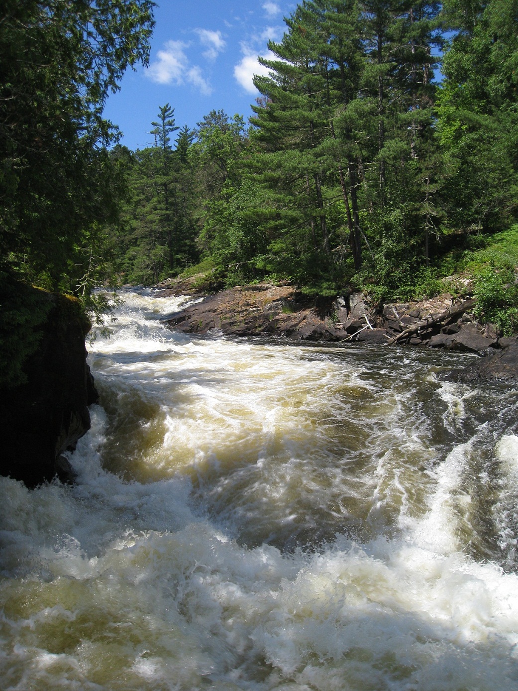
Day 5 was our waterfall day. We paddled west on Argo before heading southwest on the Siobhan River back to Crooked. Several of my youth tried carrying the canoes (and did quite well). From Crooked Lake we passed Curtain Fall into Iron and Rebecca Falls into McAree, where we ate lunch. We faced a strong wind paddling up McAree, but we eventually made it it to our campsite at the far end of the lake.
 |
| Curtain Falls |
 |
| Rebecca Falls |
There were a couple things I did not like about McAree Lake and out campsite. Firstly, we saw some motorboats. Generally these are not allowed into the Quetico, but guides from the adjacent reservations are allowed to take them out on a few certain lakes. Secondly, the campsite had some issues with Leave No Trace. In this campsite the fire rings (multiple!) were much too big, there were fire grates left there, and someone had cut into a couple of trees to wedge in a rock to form a table. Things like this don’t really make me happy. Otherwise, it was a pretty good day.
Day 6: McAree Lake to Brent Lake
This might have been our most challenging day. Fortunately by this point my crew had portaging down, so the fact that some were pretty hard wasn’t too bad. From McAree we came into Minn Lake and crossed to Darky (also known as Darkwater) River. We were paddling upstream, which caused some difficulties (especially at the mouth of the river), but we were able to work around them. Occasionally we would have to walk the canoe through some swifts around the portage or avoid a tricky tree fallen across the river, but we made it to Darky Lake without too much issue, where we had lunch at an expansive, very nice island campsite in north Darky. From there we continued the other section of the Darky River, which has a difficult but manageable 182 rod portage. My crew dubbed it “the portage from hell” due to its wonderful combination of length, moose muck, bad footing, and steepness. It was certainly the most difficult portage we had all trip.
After the portage we made camp on the south side of an island in the west end of Brent (look for the grouping of 4 campsites on Fischer maps). Our campsite was nice, but someone at the northern campsite had built a table and left it, which I had to take apart while my crew got settled into camp.
Day 7: Brent Lake to Sarah Lake
The next day I got my crew up to do a quasi-dawn paddle. They did not want to get up early enough for a true dawn paddle, but we still got on the water fairly early. Brent Lake was as still as glass. Reflections were perfect. It was an amazing paddle down Brent. We portaged into McIntyre and then into Sarah.
I passed one of my Brigade Leaders, Matt, and naturally had an interpreter hug. I teach my crews to say “Brace” and wait for a response from the other people in the boat every time they get in or out of the boat so that no one is taken by surprise. So Matt’s and my boat get close and I tell the person in the front of my boat “Brace!” and jumped out without giving him any clue to what I’m doing. When I talked to him later, he said he was thinking “Brace! Wait… what?!?” It was pretty fun.
We made our camp in a sheltered campsite on Sarah that my crew had stayed at on their last trip. It would prove to be a good choice. Most of our day was relaxed with fishing and napping, but it was hot and muggy. An evening swimming was great for cooling off. It was 4th of July, so I made a yellow cake with chocolate swirl.
 |
| Boat with Irises |
That evening we had the biggest storm I have seen up here. Fortunately, it was sheltered, so the fury of The Storm was somewhat diminished. There was rain, lightning at 2-second intervals, and large gusts of wind. It was enough to blow around some dishes and loosen a dining fly, but we were spared the worst. Crews in other parts of the park had trees come down and canoes get blown into the water. We were very fortunate.
Day 8: Sarah Lake to Burke Lake
The next morning I woke up early and made cinnamon rolls and let the crew sleep in a little bit later than usual after The Storm. After breaking camp we headed south out of Sarah. The way out of Sarah toward North Bay is several medium length portages divided up by small lakes. The longest and worst is the very first out of Sarah. In previous years these adults had called it “the portage from hell,” but because it was either at the beginning of the day, late in the trip, or because my crew was so good at portaging, they agreed that it was not nearly as bad as they had remembered.
Isabella Creek is probably now one of my favorite parts of the park. A short portage leads you to the creek, where you can paddle. It is a small winding creek with several beaver dams. However, water is clear and shallow; you can see the beautiful sandy bottom. When you do have to get out of the boat to go over beaver dams, it is even pleasant to step out.
We camped on the island across from the Yellow Brick Road in Burke Lake (the same one as I did my last night my last trip). This time we were rewarded with ripe blueberries on the top of hill! By chance I had saved cheese cake for our last dessert, to which we added blueberries. It was one of the best desserts I have had up here ever.
 |
| Blueberry Cheese Cake!!! |
 |
| Sunset on Burke |
Day 9: Burke Lake to Base (Moose Lake)
Our last day was another perfect day. We cruised across Yellow Brick Road. Our youngest scout carried the canoe and did a fantastic job. We stopped by the ranger station, chilled on an island (not Scout Island) for a brief while before coming into base.
Our last day was another perfect day. We cruised across Yellow Brick Road. Our youngest scout carried the canoe and did a fantastic job. We stopped by the ranger station, chilled on an island (not Scout Island) for a brief while before coming into base.
The youth of my crew put on a great skit about Leave No Trace at Rendezvous, which started out with things we did and got more and more ridiculous.
So far this year I have been blessed with two outstanding crews. If the rest of my crews can match them, I will be one of the luckiest interpreters on base. Props to them for making these trips so wonderful.
Tuesday, June 28, 2011
First Trip as an Interpreter
And I’m back! The trip went great, despite the worst weather I have ever seen here. My crew (5 people) was great; I am not going to go into details to protect their privacy, but suffice it to say that they were fantastic. Our trip lasted 7 days and 6 nights and covered about 63 miles. We had one layover day (we were wind-bound on Lake Agnes).
 |
| Canadian Portion of our Trek |
Day 1: Base (Moose Lake) to North Bay (Basswood Lake)
The first day we got out of base at a reasonable time, 8:50 (at least considering how long it’s been taking many people as the system shakes itself out). We made Prairie Portage before 11:30, and were able to check in and eat lunch before any other crews arrived. As we were getting ready to leave a couple came up. As far as portaging goes, the day was actually one of our easier days. We had Prairie Portage, Yellow Brick Road, and two out of Burke Lake out to North Bay. We camped on one of the northern islands that was right next to an eagle’s nest.
Day 2: North Bay (Basswood Lake) to Grey Lake
Day two was a lot rougher than the first. We had several portages, one which we river walked. We had some difficulty finding the portages from out of Shade Lake and to Grey Lake, but we eventually were able to find them. The portage into Grey Lake took us through a swamp which was interesting. There were logs through the swamp that served as a path, but after a couple of days of rain they were slick. Everyone except our two adult leaders fell in the 2-3 foot deep moose muck at some point (including myself). If it wasn’t tricky to get out it would have been hilarious. Around 2-ish we decided to call it a day and camp on Grey Lake instead of pushing all the way to Kahshahpiwi due to rainy weather and rough portages. The campsite was fairly nice, although it was a little hidden back on the point.
 |
| Overview of our Grey Lake Campsite |
Day 3: Grey Lake to Trant Lake via Kahshahpiwi
It turned out that deciding to camp on Grey Lake instead of going on to Kahshahpiwi was a great choice. We had another rough day of portaging, including one that took us up a rock face. After arriving on Kahshahwipi and eating lunch at an old campsite (sadly now burned), we decided to push on to Trant Lake.
To give a little background on the Kahshahwipi-Trant portage, it runs through a valley with a stream/swamp. On older Fischer maps, the portage is actually marked as two separate portages. In 2004 when I crossed it, it had become a single, longer portage, a change which new Fischer maps reflect.
Now after arriving at the portage, I helped load up my crew and started them along the trail before getting my stuff together. As I go up the trail a stream diverts onto it. I pass by a fairly sizable beaver dam and keep going. About 20 yards later, I run into my crew backed up. The portage trail has disappeared into the beaver’s new pond. We backtrack, scale the beaver dam and load the canoes.
 |
| One of the Beaver Dams |
It slowed us down a little, but it wasn’t too bad. Hey, it was a little less portaging we had to do! So we paddle down the new pond, passing swamped pine trees, some alive, some dead, until we reached another beaver dam. Without too much issue we crossed it too. After a short paddle, we ran into a third beaver dam. Fortunately, after crossing it we found the portage trail again and were able to finish up without difficulty.
The Trant campsite was really pretty nice, and one of my participants was able to catch a nice bass, which unfortunately, was the only fish we got the chance to catch all trip (often due to weather).
Day 4: Trant Lake to Agnes
The next day down to Agnes through Silence Lake wasn’t too bad, although it was a windy day. We were mostly on small lakes, so were not affected too much. Several of the portages had recently down trees (we actually had to break out the saw for one), so we were probably one of the first groups down this route this season.
Once we hit Agnes, we spent about an hour eating lunch and trying to wait out the wind. I did a little bushwhacking to try to find a close by campsite (I found two) that we could stay at for the night. The wind never died down, but we were able to paddle to the campsite without too much difficulty.
Day 5: Wind-bound on Agnes
The original plan was to dawn paddle down Agnes. However, the weather did NOT cooperate. When I awoke at 3 am, the wind was still howling and the rain still coming down. After reanalyzing and talking to the crew later that morning, we decided to have a layover day and try again the next day.
Day 6: Agnes to Burke
Sadly, we were unable to dawn paddle the next day either. We still got up earlier than usual and were on the water by 6. We made it down Agnes quickly despite wind and rain. We stopped briefly at Louisa Falls (no swimming in the bathtub this time) before heading on to the B&B (two back-to-back half-mile portages. The name doesn’t come from Bed & Breakfast). My crew, which had sharpened their teeth on the difficult portages up to Kahshahwipi pushed through that portages with ease. Without further ado, we passed through Sunday Lake on our way to Burke Lake. We got a nice island campsite that overlooks the Yellow Brick Road portage. There is a nice hill behind the campsite that overlooks Burke, the portage, and a small part of Basswood Lake beyond.
I learned a valuable lesson as an interpreter this day. When we got into camp, I made doughnuts for lunch. NEVER eat doughnuts with Hudson Bay Bread.
 |
| From the Hill behind our Campsite: Burke, Yellow Brick Road, Basswood |
Our last day was our only sunny day the entire trip. We slept in – woke up at 7:00 – and packed. We made it to Prairie Portage early, so we relaxed there for a while (we cannot come into base before 2:00). We were about an hour early on Moose Lake, but instead of hanging out on Scout Island like most crews, I took my group over to a small rock face and took them swimming, since they hadn’t gotten to all trip. Overall it was a great trip.
Saturday, June 18, 2011
On Trail!
Today I head out on water with a Kahshahpiwi entrance point. Be back in 7 days!
 |
| Kahshahpiwi in the morning, courtesy of Dad, 2004 |
Friday, June 17, 2011
Brigade Swamper Campsite Evaluation
When I started this blog, I foresaw a couple of different uses for it. Firstly, it would function as a way for family and friends to be able to keep up with my summer adventures. Secondly, it would serve as a kind of journal for myself. Thirdly, it might encourage people to attend Northern Tier, work up here, or even just make time to take a trip up to the Boundary Waters. Finally, it would become a resource for other canoeists to use.
This entry evaluates the campsites that I stayed at during my Brigade Swamper trip to help other canoeists plan their trips. I evaluate campsites on along the following criteria:
- -Number and Quality of Tent pads
- -Canoe landing quality
- -Campfire & common area
- -General cleanliness of the campsite
Other criteria might also be considered:
- -Swimming area
- -View from campsite
- -Traffic
- -Nearby points of interest
In the B.W.C.A.W., each campsite is given a number, which can be found on the latrine. Although there is no official map publically available showing these numbers, I will use this system of labeling. For each campsite, I will show its location on the map, give a brief description, and rate it on a scale of 1-5 stars.
Basswood Lake Campsite #103 – Back Bay
3 Stars
 |
| Back Bay Campsite 103 |
 |
| Back Bay Campsite 103 |
This campsite is on an island in Back Bay. It has enough room for tents, but the canoe landing was only moderate. The campsite was also trashy; we found a car charger, cans (not allowed in the Boundary Waters), a welcome mat, and more. The campsite lies in a motorboat zone and so receives heavy traffic. We did see a beaver at this campsite however.
Fourtown Lake Campsite #1
4 stars
 |
| Fourtown Campsite #1 |
 |
| View of the rocks & flowing water by the campsite |
Crooked Lake Campsite #13 – Mouth of Friday Bay
3 – 4 stars

 |
| The few places to put tents up in the campsite on Crooked |
This camps site was previously rated 4 stars by my family. It has a sloped rock landing, which makes getting in and out of the canoe (wet or dry foot) difficult. The campsite also has limited tent pads. However, the campsite does have several perks. Firstly, it has large rocks that are great for drying, sunning, and sitting. Secondly, there a very nice jumping rock nearby (by Northern Tier policy, a jumping rock must be no greater than 5 ft. high and must have at least 12 ft. of unobstructed water beneath it. This rock satisfies these requirements, although it must be checked every time to make sure changes in water level have not rendered it inappropriate). Thirdly, there is an old, rusting out car on the Canadian side of the lake nearby that can be visited. Fourthly, the campsite has a nice view over parts of Crooked Lake.
Basswood Lake Campsite #64 – Mouth of Basswood River
3 stars

 |
| Campsite a little bit off the mouth of the Basswood River |
Basswood Lake Campsite #128 – Between Rice Bay and Prairie Portage
3-4 stars

 |
| Front side of the campsite just past Rice Bay |
We actually arrived at this campsite at 8:30 after our dawn paddle. The front side of the campsite has a so-so landing and can be subjected to strong winds. However, if you go around to the back (Prairie Portage side), there is a nice landing and sheltered places to put tents. The campsite’s proximity to Prairie Portage can make it a nice last night stop before heading into basecamp. Other than the wind, I only complaint I have is that there is a lot of motor boat traffic that passes it going to or from Prairie Portage.
End of Staff Training & Departure of Interpreters
So this blog is a little late, as we actually finished training about a week ago. It’s just been so busy that I haven’t gotten around to it. After we got back from our swamper trip, we jumped straight back into training. We covered a couple of important topics, such as customer service, but then we got to a variety of interesting seminars put on by the Alumni Association. I personally attended “Advanced Fire Starting,” “Advanced Baking,” and “Stolen Tricks that work.” All were very interesting and should prove helpful on trail. Other seminars offered included fishing, advanced paddle strokes, a nature walk, local wildlife, local geology, and the stargazing.
That evening, the Alumni Association threw for us the “3rd Annual Paddle Ball,” which was surprisingly fun for someone who doesn’t usually dance. There are some pretty impressive dancers on staff here.
Most of the staff got a day off after training. I went down to Virginia with Bobby and couple of other people to see X-men: First Class. I thought it was pretty good, although it did move a little fast.
Almost sadly, now that training is over, interpreters are heading out on water. I may not see friends that I’ve made during training for the rest of the summer, especially if our schedules don’t match up. Even if we manage to see each other on water, the most we’ll likely be able to do is the Interpreter Hug. In the meantime, it was fun being able to spend time with friends before heading out on trail, whether it was just hanging out with them in the lounge or helping to plan trips.
Thursday, June 16, 2011
An Interpreter Life
So what do interpreters do when they are not on water? Contrary to popular belief, we unfortunately don't get trip after trip after trip. So what do we do? Well, firstly there are Daily Duties. Daily Duties are just a way to help out around base when we don't have a crew. These include cleaning the Sandy Bridges Program Center, bathrooms, and the cabins, but also can helping maintenance fix things, commissary pack food for people, outfitting outfit people and history staff entertain and teach participants. Some of the Dailies can be fun, or at least interesting, but others, such as the cleaning, are just annoying (at least to me). Fortunately, once the season gets really up and going, interpreters won't be stuck on them for two long.
An interpreter's schedule might look like this:
Day I: get a crew
-find out information about your crew, pack food packs, gear packs, plan your route with your crew, and do a shakedown with your crew
Day II: get on water as soon as possible after breakfast
Day III-Day ?: the trek
-treks can last anywhere from 5-10 days
Day ?: get off water
-get off water after 2:00 PM, shower, clean up, go to rendezvous (voyageur campfire)
Day ?+1: see your crew off
Day ?+2: Work day!
-When you don't have a crew, you do you do Daily Duties!
Day ?+?: Day off
-One or two days between crews, you get a day off
The cycle repeats, although occasionally a wrench gets thrown in: a crew shows up a day early, a voyageur brigade (no interpreter) comes, or there was a planning fluke and they need to send you right back on water. Or you might just have one day off and and then you get another crew.
Sadly, things don't always work this way at the beginning of the seasons. With all the new staff getting out of training, there are more interpreters on base than can be quickly sent out on water, even with large days (our first day of the season was 16 crews). There wasn't enough cabins free for us, so we had to move to a tent town. I counted 25 tents and 2 hammocks in the area around me, but I know there were more.
 |
| Tent city |
Fortunately, this shouldn't happen too often during the season, although it's no big deal if it does. I'm just a little bit antsy sleeping in a tent but not yet being out on the water yet.
But tomorrow I get a crew!
Monday, June 13, 2011
Brigade Swamper
Thursday afternoon we got back from our swamper trip. Swamper gives new staff the opportunity to get some firsthand training on trail. Our brigade was led by two more experienced guys, Mat and Roni. After a couple of days of showing us how to do things, they stepped back and let us run the show by appointing one of us the “Leader of the Day,” who was supposed to act and lead like an interpreter would. I thought it was a brilliant system, although our brigade was naturally more efficient and trained than a regular crew would be.
The trip itself was great! Our planned itinerary was changed very quickly after we left base. Instead of doing the Horse River Loop, we decided to extend the trip and go past Horse Lake into Fourtown Lake. Our new itinerary was as follows:
Day 1: Moose Lake (Base) to Back Bay (Basswood) via Wind, Indiana and Good Lake.
Day 2: Back Bay to Fourtown Lake via Pipestone Bay, Jackfish Bay, Sandpit, Tin Can Mike and Horse Lake.
Day 3: Fourtown Lake to Friday Bay (Crooked Lake) via
Day 4: Friday Bay to the mouth of the Basswood River on Basswood Lake
Day 5: Basswood Lake to Basswood Lake
Day 6: Basswood Lake to Moose Lake (Base) via Prairie Portage and the Moose Chain
 |
| Our Trek |
The first day, we had breakfast on base, checked out our fuel, PFD’s, and canoes, and finally left. We paddled across Moose Lake and portaged into Wind Lake. From Wind Lake, we portaged into Basswood. We wanted to hit some smaller lakes instead of going around the peninsula, so we paddled down a creek and portaged into Indiana Lake. From there, we went to Good Lake, where we had a floating lunch. I like floating lunches. Instead of pulling over at a campsite and getting eaten by bugs, you pull your three canoes together and eat on the lake. Anyways, from Good Lake we portaged onto Basswood Lake, where we made camp on an island in Back Bay. That evening, a beaver came up and started eating by our campsite! I don’t remember seeing beavers up here before, so it was pretty cool to see one right on the first day.
The next morning we got up early to get across Pipestone and Jackfish Bay (both of Basswood Lake). From there, we did a little creek paddling through Sandpit and Tin Can Mike Lakes to Horse Lake. We made camp by some small rapids on Fourtown Lake.
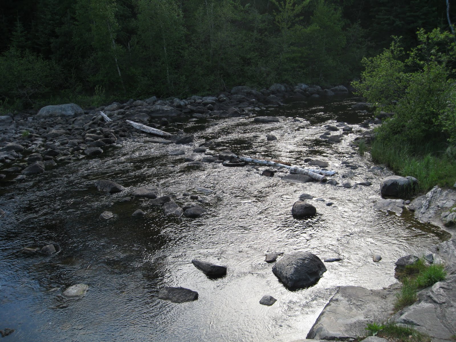 |
| Rock area by our campsite |
Before we changed into dry clothes, we took the opportunity to practice swamping drills. It was fun to get into the water and swim around, even wearing boots and a PFD (Northern Tier policy).
 |
| Fourtown in the Evening |
Our third day was also interesting. It was characterized by creek paddling, portaging and smaller lakes. We traveled through Fourtown, Boot, Gun, Wagosh, Niki, Chippewa, and Papose Lake and finally ended up on Friday Bay on Crooked Lake. Our campsite was next to a nice swimming place, which we took advantage of for a little while before deciding the water was too cold. We stopped for lunch on Niki Lake, where, unfortunately, the bugs were rather bad, which led Roni (who is Jewish), to complain that the horseflies were “Anti-Semitic.” We saw another beaver during breakfast, several eagles throughout the day, and even a river otter on Papose Lake.
 |
| Crooked Lake at Sunset |
 |
| If you ever doubted the bugs here, doubt no more. This is what we would wake up to. |
On the fourth day we ran into weather issues. We got up early and managed to paddle about 3 miles before the storm caught us, but we were forced to pull over and hide erect the dining fly. After the thunder subsided, we got back and the water and finished paddling Crooked Lake to the Basswood River, stopping only at the petroglyphs. The petroglyphs, which you are not allowed to take photos of, are one of the most complete and extensive sets in the Boundary Waters Canoe Area. Also along the Basswood River are several sets of waterfalls. The falls are spectacular, but I was unfortunately unable to get pictures of them this trip as my camera was packed at the bottom of my bag. We ended up camping at the mouth of the Basswood River on Basswood Lake. Despite the rain earlier, the day actually turned out fairly nice.
 |
| Camp on Basswood |
Unfortunately, my nap caught up with me the next night. I wasn’t able to sleep as well that night and ended up waking early and wandering around camp.
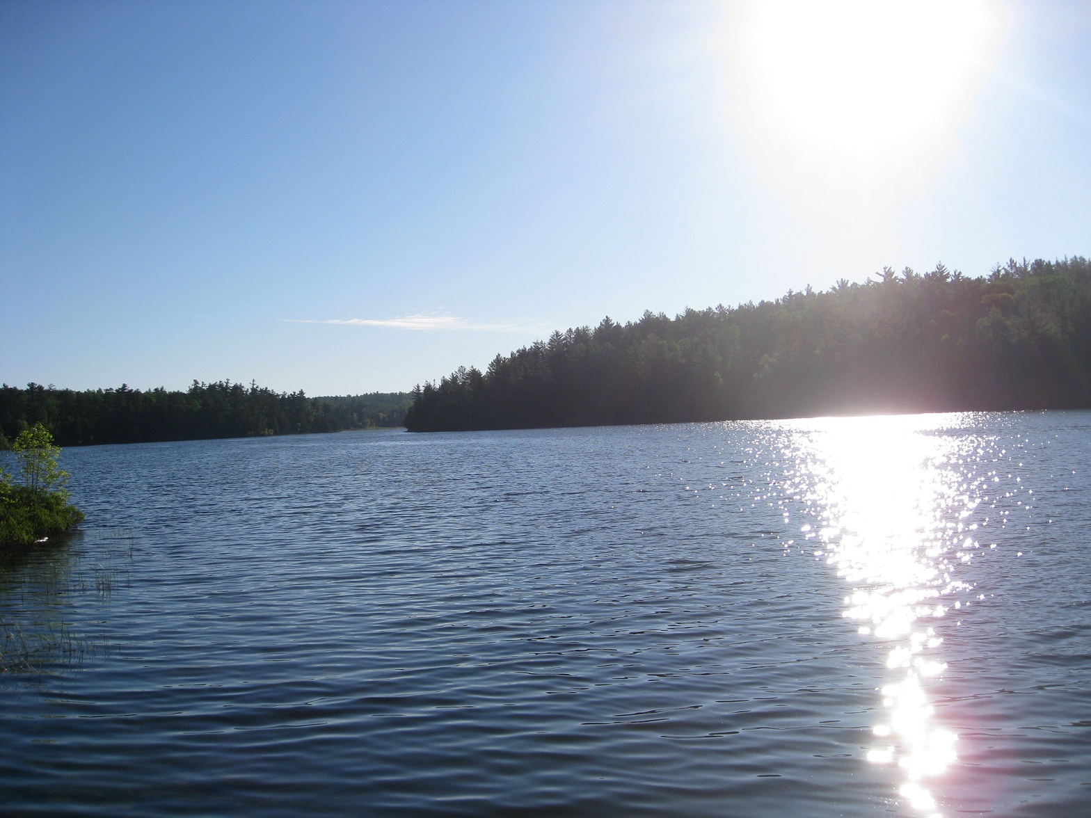 |
| Basswood in the morning |
After we finally got up, we paddled a short distance to Prairie Portage, where we got small tour. As I have a Quetico Pass this summer, it was useful to hear where everything was done there. We went down the Moose Chain and waited on Scout Island for about 20 minutes before going into camp at 12:30.
One thing that annoyed me on this trip was the trash. We found a lot of trash in our campsites, from cans, bullet casings, a carpet rug, to a porcelain toilet.
 |
| I kid you not, a toilet. |
We found the toilet our 4th night, by the mouth of the Basswood River. As the devoted followers of Leave No Trace that we are, we decided to portage it out. Besides, it was completely hilarious. The next day we ran into some rangers who had been looking for the toilet after getting a complaint. Moral of the story? Pack out your crap!
 |
| Mat on his throne |
Thursday, June 9, 2011
Saturday, June 4, 2011
Swamper I
Today we leave for our swamper (interpreter training trip). It's a six day, five night trip. Our planned itinerary is the Horse River Loop:
Moose Lake to Good Lake via Wind Bay
Good Lake to Pipestone (on Basswood)
Pipestone to Horse Lake
Horse Lake to Basswood via the Horse River
Basswood to Rice Bay (on Basswood)
Rice Bay to Moose Lake (Base)
We should see some cool stuff on the trip, including some pictographs and Basswood Falls. We are currently planning a night/dawn paddle on Basswood too. On the down side, we there may be some marshy areas with moose muck and there are lots of open areas that could give us wind problems. I'm pretty sure it should be fine though.
Although we aren't doing a lot of miles, this is a training trip. For instance, we are taking a piece of every type of equipment the Bay Post has so we can experiment and figure out what works for us. We're also going to be practicing things like swamping recovery, strokes, and cooking with the Northern Tier food.
See everyone in six days!
Subscribe to:
Posts (Atom)